3D Cartography

The art of digital morphology

OurOurreliefreliefmapsmapscombinecombinegeographicgeographicprecisionprecisionandandavant-gardeavant-gardedesign,design,turningturningelevationelevationdatadataintointogenuinegenuinecartographiccartographicartworksartworks

Beyond data

The core principles founding our modern cartography

[0x01]

Custom design

Each map is designed from scratch, balancing aesthetics and geographic terrain

[0x02]

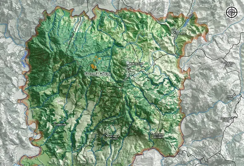
Geographic precision

High-resolution elevation data ensuring absolute geographic accuracy
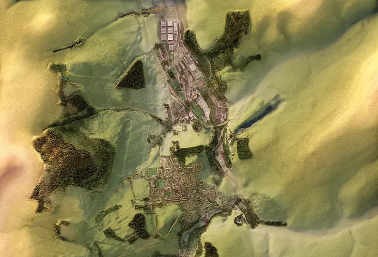
[0x03]

Visual impact

A three-dimensional relief crafted to bring depth and character to your environment

3D topographic map of the southern tip of Africa featuring political borders and country names including Namibia, Botswana, Zimbabwe and South Africa. The relief highlights coastal mountain ranges and interior plateaus
Perspective relief map of the Acate area in Sicily. The relief highlights the canyons of the area and waterways are visible
Topographic relief map of the Aeolian Islands with blue contour lines without elevation on the water and depth indications
Topographic relief map of the Elqui River valley in Chile, showing the changing names of the river along its course to the ocean
Shaded relief topographic map of the Pyrenees mountain range, showing detailed ridge and valley terrain with blue numbered pins marking the 128 main peaks based on the 1995 UIAA classification

Our workflow

From concept to completion

Grayscale topographic map detail of an Icelandic volcanic landscape. It uses ambient occlusion to create soft shadows that define deep valleys, a large smooth glacier plateau and a distinct volcanic crater in the lower center
[0x01]
A magenta wireframe icon of the Earth globe surrounded by three orbiting satellites, with radar rings at the base, representing geographic data acquisition

Acquisition

Transforming terrain, survey inputs and coordinate systems into structured cartographic dataset
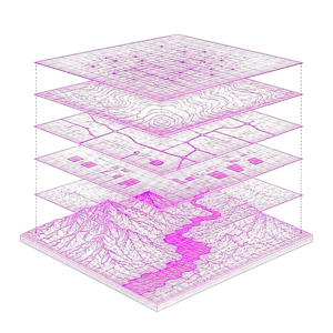
A flat 2D vector map excerpt of Iceland's terrain, focusing on the Mýrdalsjökull area. It features solid color blocks for green valleys and white glaciers, overlaid with thin brown contour lines, an orange trail and text labels without any 3D shading
[0x02]
A magenta wireframe icon showing five stacked isometric data layers, transitioning from abstract grid networks at the top to a detailed 3D topographic terrain at the bottom

Design

Assembling layered geographic data into a coherent shaded-relief map composition
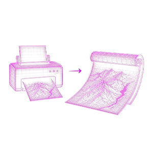
topographic map snippet of Iceland combining color terrain and labels with realistic 3D shaded relief. It details the snowy slopes of the Sandfellsjökull and Kötlujökull glaciers, accented by brown contour lines and subtle mountain shadows
[0x03]
A magenta wireframe icon depicting a desktop printer with a topographic map coming out, connected by an arrow to a curved, high-quality printed map sheet

Post-production

Refining chromatism, contrast and material perception for print and digital formats

Aligned with your coordinates

Designed for your needs
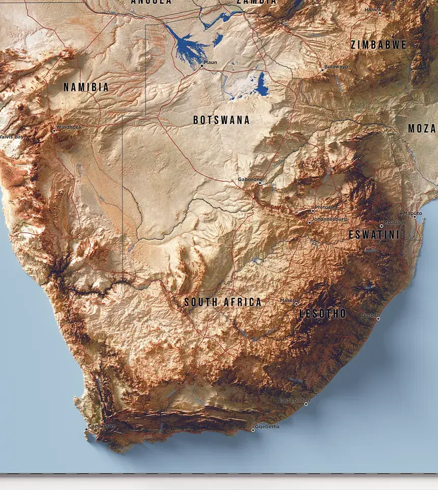
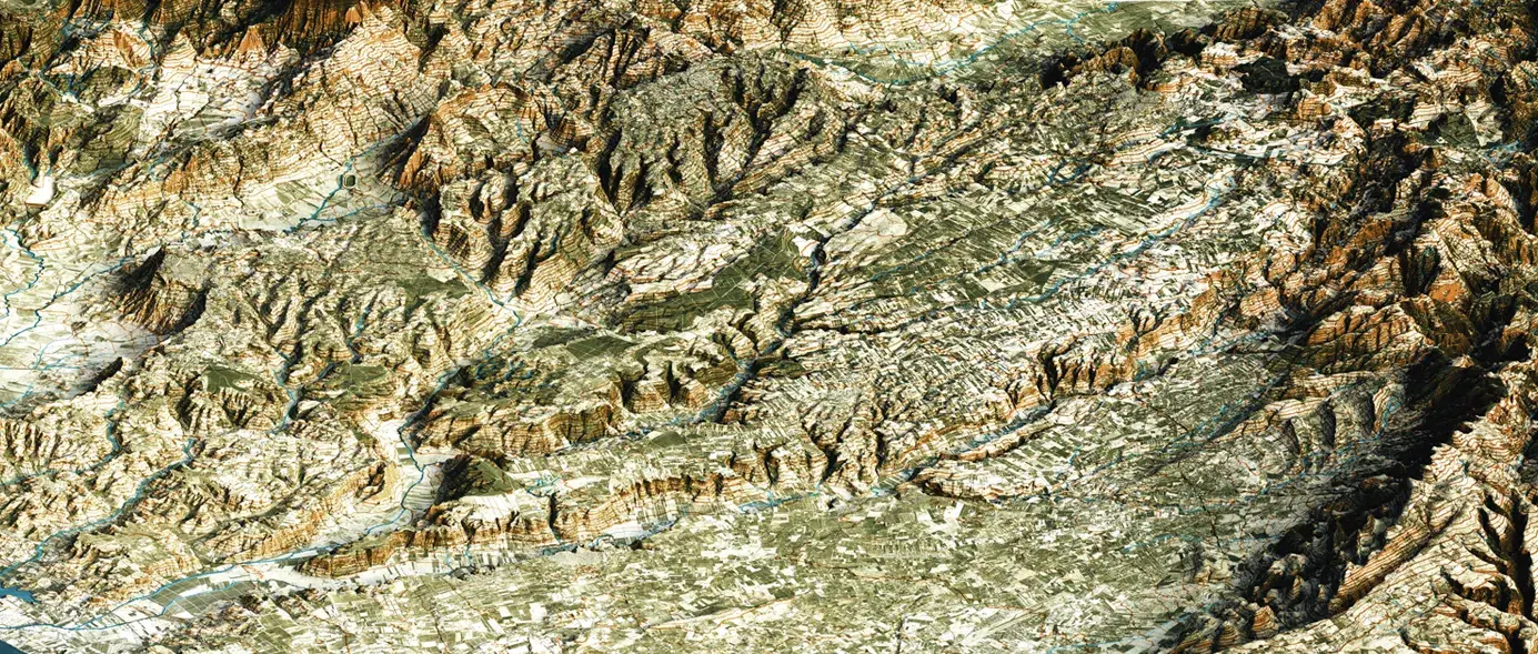
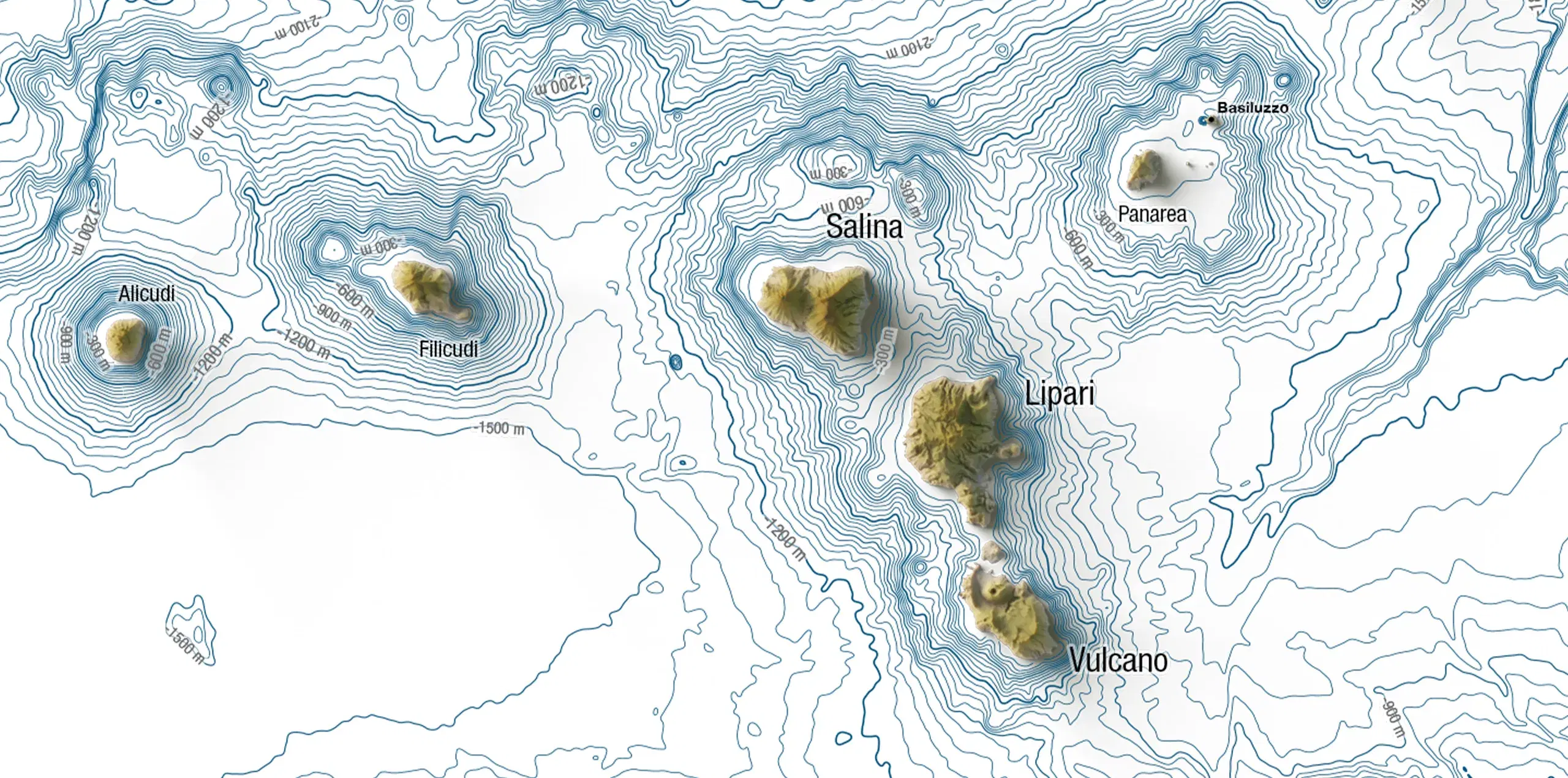
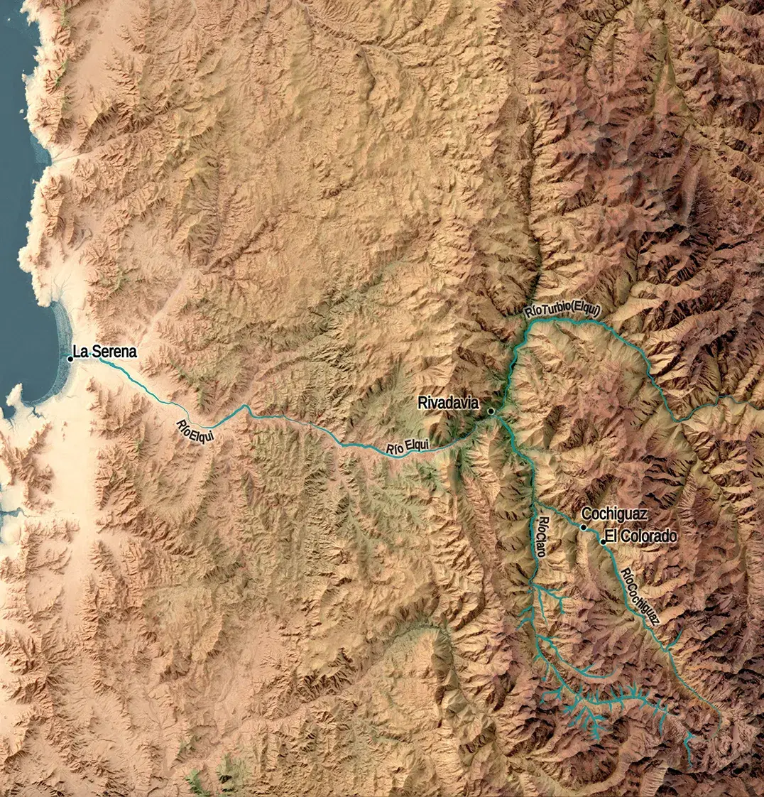
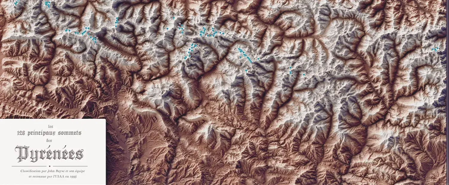
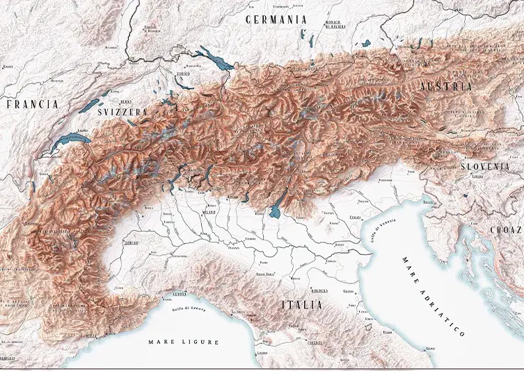
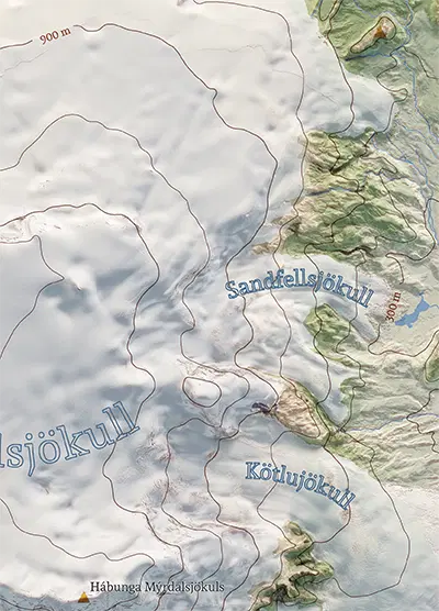
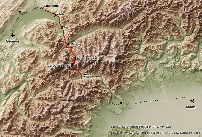
1.0x
SubtleDramatic
315°
NorthNorth
0.5x
SoftCrisp

Selected work

A curated pick of our finest shaded relief maps

Shaded relief topographic map of a section of the Via Francigena between Switzerland and Italy. A bold red line highlights the route winding through rugged alpine terrain from Lausanne, passing through Vevey, Aigle, Martigny, Bourg-Saint-Pierre and Col Du St Bernard, down to Aosta. Dashed black lines indicate travel connections to Geneva and Milan, marked with airplane and train icons

Francigena Trail

Custom section of the Via Francigena trail, commissioned by a private client

See all
A detailed 3D shaded relief topographic map of Dufftown, Scotland, showing the town's layout nestled within a rolling green valley. Dense clusters of dark green trees and patches of agricultural fields surround the residential grid, while large industrial distillery complexes with grey rooftops are visible on the northern outskirts of the settlement

Dufftown, United Kingdom

City of Dufftown, Scotland, for Build in Amsterdam

See all
Topographic shaded relief map of the Brunello di Montalcino wine region in Tuscany. The area stands out in vibrant green against a desaturated grey background, showing mountain terrain, blue rivers and text labels for Montalcino and Castello Romitorio

Montalcino, Italy

Montalcino area, Tuscany, for Castello Romitorio

See all

Contexts

Maps designed for people, spaces and organizations

[0x01]

Interior Design

Shaded relief maps designed as focal elements for contemporary interiors

[0x02]

Branding & Editorial

Cartographic systems and assets for refined brand identities and high-end print publications

[0x03]

Exhibitions & Installations

Large-scale geographic compositions for immersive cultural and spatial experiences
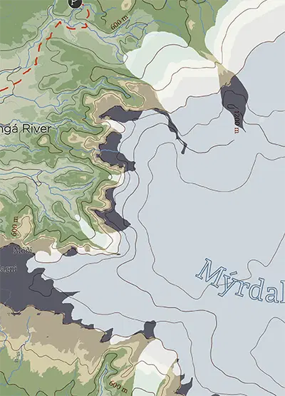
[0x04]

Tourism & Heritage

Cartographic works that reinterpret landscapes, landmarks and historical territories

Available for projects

Do you have an idea for a project? Tell us about your landscape and let's create a unique artwork together

hello@vizart.io